A couple days ago Kat tells me ‘she misses hiking with me’ but quickly
adds ‘she isn’t up for a long hike,
and not a lot of elevation change either and definitely no bushwhacking’. That got me thinking, where could we go that
would meet her criteria? It took me awhile, but I finally settled on Railroad Grade Trail out of Gilbert. At about five miles, she said it’s longer
than she was looking for but two out of three isn’t bad, she said, “let’s go
for it”.
 |
pillar of concrete rising from the Buffalo
|
The trailhead along with parking and restrooms are located about halfway
between the canoe launch area and the old Gilbert General Store on the east
side of the road. Parking is tight with room for maybe four, the
trailhead just north of the vault toilets is clearly marked. We head east on the trail after a little
chit-chat with a couple young NPS maintenance workers getting set-up to clean
out some dead timber at the launch area. |
| water tower foundation |
 |
Railroad Grade Trail: flat wide and clean
|
Right away on our right are the concrete piers which supported the
long-gone railroad water tower. This trail on the
old roadbed for the Missouri and North Arkansas Railroad is as flat and smooth
as a lake at sunrise, easy going to be sure.
As we continue east, on the north we’re looking into an RV park/campground
with rental cabins to boot. |
| Buffalo River on the right |
 |
...and bluffs on the left
|
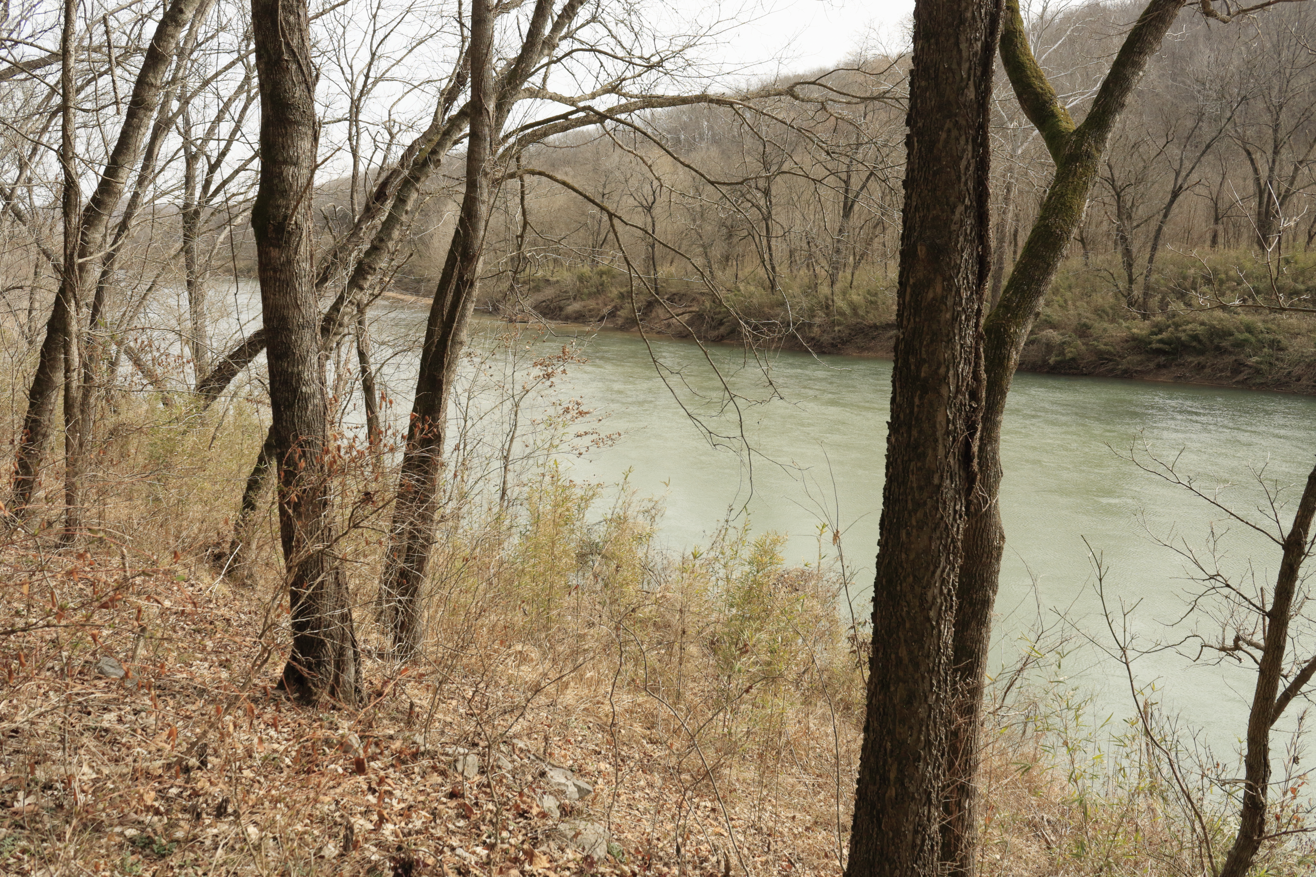
Then for about a mile is a bluffline on our left and the Buffalo River
on the right, today the river is high and running fast. Since the trail is so easy we make pretty
good time and soon come to a nice two-tiered wet weather waterfall. About 300 yards past the waterfall the trail
leaves the railroad grade down a steep descent to a small creek crossing. The creek is mostly dry, I walk downstream to
check out the bridge pilings and stonework of the trestle that has been
removed. |
| I was left in her dust |
 |
2-teired waterfall (just add water)
|
Up the other side and back on the railroad grade it’s more flat easy
hiking along the bluffline, here are three or four large rocks laying on the
roadbed that have fallen from the bluff, one of these has a low tunnel through
it. We soon come to a trail intersection,
we take the little steep side trip down to a great vista point with wonderful
views of the Buffalo and the confluence of Bear Creek. Also here is a view of a stone culvert under the railroad and over to
the east a tall shallow cave.
 |
| stone culvert? down near creek crossing |
 |
Bear Creek confluence next to old road
|
Back up on the trail which soon starts a long gradual turn to the north, is where we cross paths with a flock of wild turkey. Then a little further is a trail intersection, the trail to
the left leaves the railroad grade down a little hill. I don’t know of any name for this trail which follows Sand Hole Road to the Buffalo, crossing on a shoal at the base of Red
Bluff then up the hill to Boy Scout Monument before ending at the Buffalo River
Trail (see: 203 River Crossings Loop) .
 |
| culvert under roadbed |
 |
trestle piers on the Buffalo
|
We stay on Railroad Grade Trail curving to the right and south. Before the end of the roadbed the trail heads
down the steep hill southwest and winds its way down to the Buffalo River at
the four tall lonely concrete trestle piers.
They are all that’s left of the long railroad trestle that once spanned
the river and was demolished sometime after the rail-line shut down in
1946. Gilbert began as a
construction camp for the railroad around 1900, this line of the Missouri and
North Arkansas Railroad opened for business on December 1, 1902.
 |
| Buffalo River above trestle |
 |
jammed log lunch spot
|
Exploring the gravel bar around the piers we stop for lunch on a large
log jammed against one of the bridge abutments.
After a long break and a few photos, we begin the return hike on Railroad
Grade Trail back to Gilbert. Kat held up
just fine today and we both had a great time on this outdoor adventure in the Ozarks.
Our total distance hiked was 4.5 miles with just over 300 feet of
elevation gain.
 |
flood gauge
|
Railroad Grade
Trail: Statistics Chart 162 Trailhead is in Gilbert, just take paved Highway 333 east off Highway 65 about
3.3 miles to the stop sign, (this is downtown Gilbert) turn right and the
parking/trailhead/toilet is on your left after about 500 feet. |
base map before fair use alterations is property of USGS--licensed under Creative Commons Attribution-Noncommercial-Share Alike 3.0 U.S. License
|
|


Comments