151 Falling Water Trailhead to 'Hidden' Hollow on the OHT

As the name implies, there are many beautiful waterfalls up and down the pristine mountain stream.
Falling Water Creek

     Two days later and I’m back on Falling Water Road to complete the section of the Ozark Highlands Trail started Friday.  On that hike I started at the campground at Richland Creek and eventually made it to the little no-name creek that contains Hidden Falls, there I left the OHT returning to Richland Campground on Falling Water Road (see: 150 Richland Trailhead to Hidden Hollow).

Falling Water Creek & Falling Water Road

    What I call a 'section of the OHT' is simply the segment of trail between two trailheads, this ‘section 19’ is the trail segment from Falling Water Creek Trailhead to Richland Campground Trailhead.  The total distance of Section 19 according to my GPS track is 5.4 miles, I hiked 3.1 of that on Friday and plan to do the rest today.

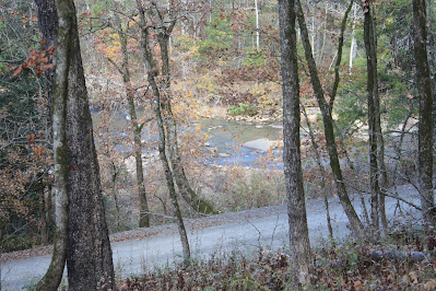
fall day on Falling Water Creek

    Today I’m parking right at the east end of the Falling Water Creek bridge on the south side of the road, and again there are other parking options nearby.  Across the road is the OHT Falling Water Trailhead, but I begin going down the road just over 100 yards to an old road trace that I’ve noticed on maps and have wondered if it may be a possible route to get upstream on the east side of Falling Water Creek.  Sure enough this old road looks reasonably clear for a future hike, and even has a desperation campsite near its entrance off FR1205.

utility lines at the wilderness boundary

    Continuing down the road only 200 feet further is the Ozark Highlands Trail where it crosses the road, I turn east and into the woods.  After passing a wet weather waterfall on the right, the trail begins to climb up the hillside.  The OHT briefly joins an old road before a short steep climb up the bank onto FR1219 (SC265) Richland Creek Road.  Across the street the OHT continues up the hill, but nothing very steep.

creek above Intersection Falls

    Soon leveling out the trail sweeps around a long curve from north to east, now I’m up above the no-name creek that sports Intersection Falls downstream near the confluence with Falling Water Creek.  Before reaching the creek, the trail turns back to the west and follows an old road down and across the creek.  The trail follows the old road maybe 100 more feet before turning to the north and under a fallen tree before heading up hill a little.

creek below Keefe Falls

    Things keep mostly flat for about half a mile through open woods, then I enter another old road and soon come to an intersection.  The road I’m on continues up the hill, but the OHT turns slightly left here on another old road and continues mostly level.  Then around a sweeping corner with some nice rock formations, I approach the next no-name creek.  This one with Keefe Falls and Splashdown Falls upstream on separate stream branches.

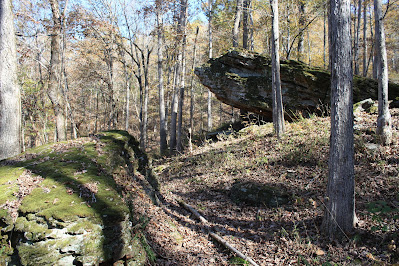
many amazing rocks...

    After the crossing it’s more of the same; up and down little hills, lots of nice rock formations and broken bluffs to the right and occasionally some boulders in the open woods to the left.  And then before I know it, I’m at that same little no-name creek where I ended up on Friday, the creek with Hidden Falls about 200 yards upstream.  But this time rather than bail-out down to the road, I turn around and go back the way I came.

...and a few dry creeks

    Going back is an easy leisurely hike, this southern half of section 19 on the Ozark Highlands Trail has many nice views down to Falling Water Road and occasionally Falling Water Creek beyond, besides the formerly mentioned bluffs and boulders, just an all-round enjoyable hike.  Near the end of today’s hike when I reach FR1205, I cross the road and stay on the OHT which goes to the banks of Falling Water Creek through a nice campsite then south along the creek to the road right across the street from my parking spot.

GPS coordinates for waypoints along the Ozark Highlands Trail (sect.19)

    I had a great time today hiking a small piece of the Ozark Highlands Trail, even though today’s Sunday I had the trail all to myself or at least I didn’t encounter anyone.  There were lots and lots of people driving up and down the road below the trail, on such a beautiful day I would have thought there’d be more people on the trails.  Today I hiked 4.5 miles with 636 feet of elevation change.

clean forest = easy hiking

    Falling Water Trailhead: There's more than one way to get here, today I drove in on Hwy. 16 from Pelsor/Sand Gap passing Pedestal Rocks Kings Bluff, then about 4 miles further turn left (east) on Falling Water Cutoff Road which has a sign for the Falling Water Horse Camp.  Falling Water Cutoff turns into Falling Water Road passes the horse camp then Falling Water Falls and eventually crosses Falling Water Creek on the narrow concrete bridge. Park here just over the bridge, there is room for maybe 6 or 7 cars along both sides of the road.  The distance on dirt roads is about 5.3 miles.

base map before fair use alterations is property of ArcGIS-
-licensed
 under Creative Commons Attribution-Noncommercial-Share Alike 3.0 U.S. License


bridge over Falling Water Creek


Comments

Popular Posts

23 Thunder Canyon Falls

21 Triple Falls

86 Fuzzybutt Horsetail and more

17 Haw Creek Recreation Area