Back to Pedestal Rocks Kings Bluff SIA (PRKB), it’s been almost a year since our last visit
so we’re about due. Today the parking lot is pretty much
filled-up, we do find a spot though. One
thing I have noticed about the pandemic, is ‘hiking’
has really gained in popularity. Or
maybe it’s just that with COVID-19 related ‘lay-offs’ hikers who once could
only get out on the weekend are now out every day of the week.
 |
multi-color bluffs
|
Whatever the reason, people need to be able
to ‘escape’ the mundane daily routine, and the great outdoors provides just
about the best escape possible, and while hiking we can easily maintain ‘social
distancing’ guidelines. It's a shame though there are no campsites here at PRKB, if there were we could spend multiple days here hiking and exploring the bluffs, caves and waterfalls. |
near Wet Bluff Grotto
|
Above you’ll notice I chose to call this hike ‘A Bluffs Bushwhack’ but
it won’t entirely be bushwhacking, we start out south over the bridge on
the Pedestal Rocks Loop to the ‘main intersection’ where we turn right (west) on the
Kings Bluff Trail. It’s just over a
quarter mile down the trail to the same bluffline break we used last year to
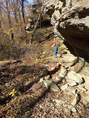
get from ‘Shelter 7’ back up to the trail (see: 29 Seven Shelters). |
Cave 39
|
This is where the bushwhack begins, we descend the steep hill passing
Shelter 7 all the way down to the small creek at the bottom. This is pretty rough going, especially as we
get closer to the creek with lots of Arkansas jungle, at the bottom we head
upstream a short way to a small shelter cave and bluff right at the creek,
I’m calling this ‘Wet Bluff Grotto’ because that's a fair description.
 |
'debris' along faint old road
|
We climb
the steep rocky hill following the bluffline to the southwest. The terrain levels out some as we angle
uphill away from the creek, then crossing a little side drainage we head uphill some more, to the west is a low broken bluff with some interesting
little caves and shelters. This is ‘Cave
39’ in Danny Hale’s numeric feature sequence and a nice place it is, after the rough and grueling quarter mile
bushwhack to get here, we’re ready for a rest, Cave 39 is just the
ticket.
 |
off-trail hiking
|
Around the west side of Cave 39 is a bluffline break that leads
us up to the top at some expansive rock patios. A rock patio is much-appreciated when on a bushwhack, with large areas of firm wide-open brush-free bedrock to wander around on and enjoy the fabulous views. On the rock patio we follow the top of the
bluff west then south where the patio ends in open woods
consisting mostly of pine, easy going for a while. Soon coming to a little drainage
with a nice 15-20 foot waterfall without much water, from stains on
the bluff we can tell this is a beautiful place after a good rain. |
approaching Cave 38
|
Continuing, around the top of the
drainage then west keeping near the top of the bluffs we soon to
another rock patio. This one not quite
as big as the last, still offers some fantastic views of the valley below. Off the patio heading south there is more undergrowth but not bad,
in about 100 yards is a bluffline break. We take the plunge down through the break, at the bottom is an old road, easy going now headed north.
 |
inside small cave
|
We pass an old
rusty box-spring with a mattress made of sticks and dry leaves, before arriving at
a dead-end and another small cave. This is Cave 38 aka Hobo Cave since the assumption is someone was living
down here in the not-too-distant past.
After exploring a little we head out, back up the old road and up the bluffline break. South in about 200 feet we pass
another wet weather fall, this one too would be quite nice with a little rain.
 |
leaky roof in Hobo Cave
|
Here at the waterfall, we leave the bluffs heading uphill to a small ridge, beyond
that around the next ridge and next drainage. Although off-trail the woods are wide open and fairly clean. We’re looking for ‘TAKAHIK Cave’
but we can’t locate it, maybe the GPS is acting up, discouraged we eventually give up. We head up this drainage to the south then east back to the main Pedestal Rocks Trail, turn north and in a little
over half a mile are back at the parking area.
 |
back at the trailhead
|
A Bluffs Bushwhack: Statistics Chart 74 The bushwhack portions of the hike were
very different from each other: first, to Cave 39 was rough and
steep with lots of undergrowth, then along the top of the bluffs
including rock patios was easy wide-open with gorgeous scenery, the last section after leaving the bluffs through the woods and out to the main
trail was not bad through mostly open woods. As far as bushwhacks go I would call it a moderate bushwhack, we had a great time of course. Today we hiked 3.1 miles with 300 feet
elevation gain. For driving directions and a map of our hikes in the PRKB see: (35 Wonders Downunder).


Comments