Owens Mountain and Ricketts Mountain while popular with rock-climbers
are not too well known to most hikers.
Owens and Ricketts are close together separated by Ricketts Knob, and
not hard to find. Just drive to the top
of Cowell Road, either from Scenic Highway 7 in Cowell or as we did from Big Creek Road
just outside of Mt. Judea.
 |
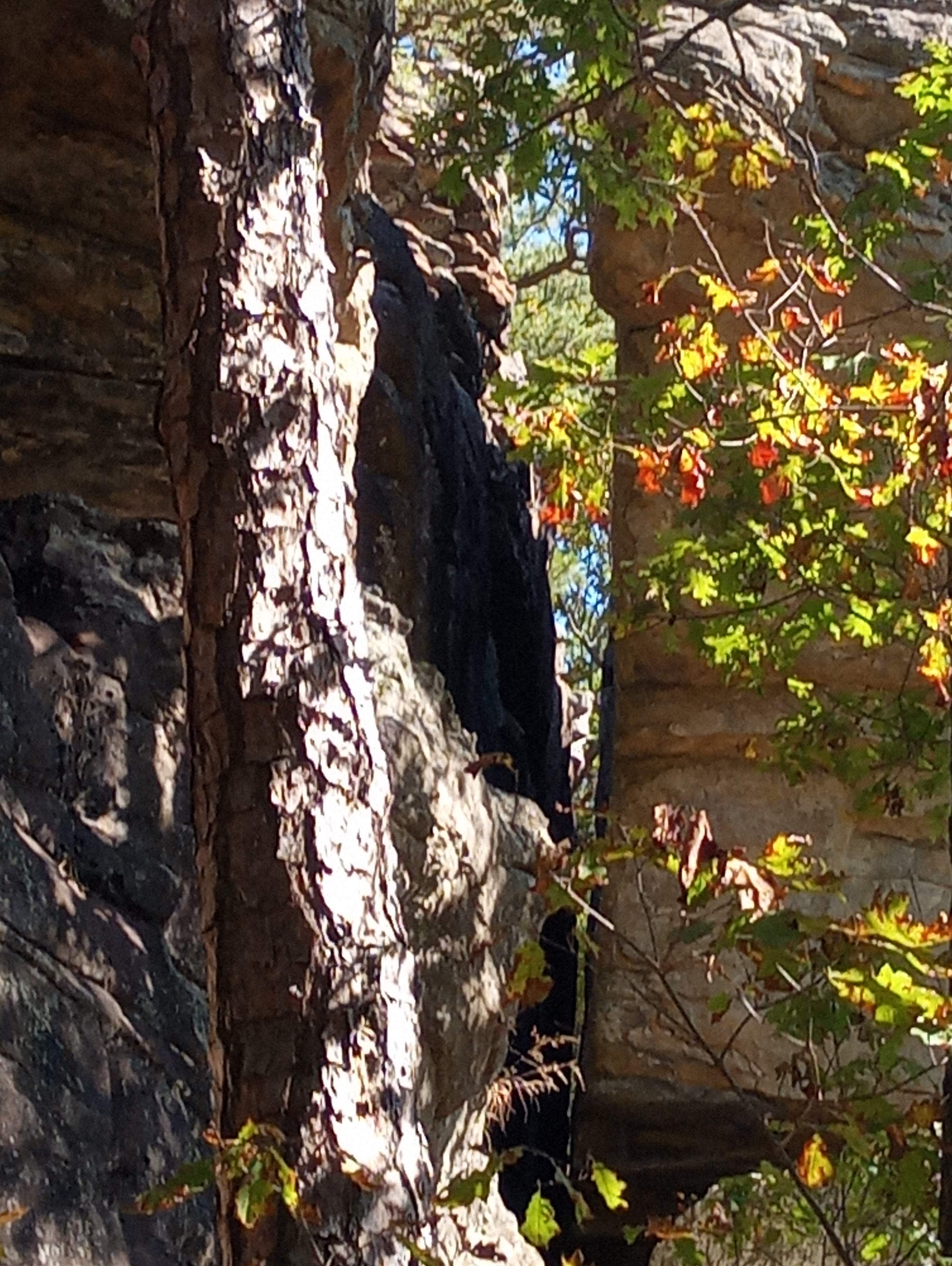
Lizard Rock
|
The road up
the mountain from Big Creek isn’t too bad, but I wouldn’t call it ‘good’
either. Near the top after a steep ‘S’
curve is an intersection, right (northeast) is Ricketts Mountain Road (FR 1204D)
and left (southwest) Cowell Road continues.
Just over a quarter mile further on Cowell Road right after a curve to
the left is a wide spot with plenty of room to park two or three vehicles, we
park here, although we shouldn’t have. |
near the top of Owens Mt.
|
There’s nothing wrong with this parking area, the problem is the
overgrown bushwhack up the steep hillside to the base of the bluffs that is
completely avoided if we had parked at the top.
To get there we should have kept
going down Cowell Road another quarter mile plus, to a sharp turn to the right
onto Owens Mountain Road (FR 1204C) then back uphill a quarter mile to the large
parking area on the right, next time
we’ll know. |
campsite on Owens Mt.
|
From our parking spot it’s a short scramble up
the bank to a small sign, this ‘notice’ informs that
‘archeological resources…are fragile and irreplaceable…are protected for the
benefit of all Americans’. There is more
information on the sign but impossible to read thanks to some morons who think this sign was put here for ‘target practice’. Up the hillside we go slowly, as I
mentioned this is a steep bushwhack through some
pretty thick jungle, fortunately it’s only about 100 yards to the base
of the bluffline that encircles much of Owens Mountain. |
long narrow bear-crack
|
We turn left to the south and follow this
amazing bluffline, through mazes of boulders, large sharp slabs of rock, small
shelter caves, rock overhangs and crevices, collectively known as ‘The Corridor’. Climbers ‘bolts’ (anchors drilled into solid
rock or hammered into cracks) are above us seemingly everywhere, we
continue south and into a tight little dry canyon with bluffs on both sides. At the south end of the box canyon, we
spot a faint trail that leads us up and out of the canyon, and right there at
the top is a road. |
Owens Bluffs for some great rock climbing
|
This is Owens Mountain Road, we follow it uphill maybe 100 yards to an
old road/ATV trail to the right. Here is
the above mentioned ‘parking at the top’ we follow the old road into the wide-open woods and notice many fine campsites scattered in the wood. About 300 yards and near a nice
campsite on the left we leave the road on a trail that heads east
toward the top of the bluffline. Here we continue north to a long bear-crack with a slab of
rock for a roof at the top of the steep crevice.
 |
Native American asterisk
|
We enter the ‘hole’ at the top squeezing through, then down this nice bear-crack to the bottom and the base of the
bluffline. Turning left we explore to
the east a short way until we come to an impasse at a small shelter cave and
dead-end. Well maybe not a ‘shelter
cave’ it’s more like we’re under an overhang and behind a huge slab of the
bluff that has fallen, whatever it is, we relax on a flat slab of
rock for a short break before heading back the way we came. |
geometric petroglyphs
|
Back at the
base of the bear-crack we continue southwest along more amazing bluffs, we
notice lots of climbing bolts above and one has a padlock on it, I assume it must
be unsafe for use. Then as we continue
south along the bluffline we meet a couple free climbers. The ‘climber’ is about 20 or 25 feet up scaling the face of the cliff while his ‘belayer’ on the ground is
tied to the other end of the safety rope.
 |
childish vandalism
|
Suddenly the climber slips and falls jerking the belayer off the ground
and for a few seconds they are bobbing up and down like a couple yo-yos, quite the show. After both are safely back on solid ground, we
talk a little about rock-climbing. Today
is their last day of a weeklong rock-climbing trip to Arkansas, they’re from
Oklahoma which has some rock-climbing locations but nothing like Arkansas. |
rock 'action' at Owens Mountain
|
Remembering that padlock we just saw, I
ask them if the ‘bolt’ is unsafe for climbing. I'm told “No, not at all, the lock is there
to protect the petroglyphs from damage caused by climbers.” Petroglyphs?
I didn’t see any petroglyphs. “Yes,
they are all over these cliffs”, he explains, “they’re hard to spot you really
have to be looking for them.”
 |
bottom of bear crack
|
Backtracking
to the padlock now we're on a mission to find some petroglyphs, and sure
enough now that we’re looking for them, we find many. All are at heights convenient to the artists
who made them, so we concentrate our search between 3-7 feet off the
ground. I have no idea how many drawings there are here, but we locate maybe ten, most are geometric designs
and hard to describe, you have got to see them for yourself. |
campground on Ricketts Mt.
|
Soon we find ourselves back at the big dead tree that we had noticed
when we first arrived at the base of the bluffs above our parking spot. Logically we make our descent to the truck
from here, it’s much easier going
downhill. We turn around and go back up
Cowell Road to Ricketts Mountain Road, turn left and about a half mile later,
left again on an old road into a parking/camping area. We park here at the south end of Ricketts
Mountain. |
bear-crack at Ricketts Mt.
|
Right off Ricketts Mountain Road this large primitive camping area is an amazing place, with room
for four or more campsites, nestled in a clean forest of large pines and massive
boulders, it’s kind of ‘magical’ for a camping area. We explore the campground
which includes shelter caves, long bear-cracks, crevices and some gigantic
boulders. We make our way to the top of two of the boulders onto rock patios, aka ‘turtle rocks’ with some great views of the camp area below. After a short break, we head
out from the campground to the west.
 |
rugged scenery on Ricketts Mt.
|
Hiking out from the campground we have many paths to choose from, and we
explore a few. To the west and then
north from the camp area are lots of huge boulders of fractured bluffs with passageways, crevices and dead-end box canyons along with some small shelters. This rocky wonderland continues for maybe 200
yards past the campground before all the trails pretty much disappear. |
north facing bluffline at Ricketts
|
We continue northeast along the base of the
bluffs, now a bushwhack that gets rougher as we go. Lots of loose rock everywhere makes for slow
going, eventually coming to a shallow long shelter with big slabs of rock which fell from the
ceiling long-ago, that we must climb over and around. Then 100 yards further is another smaller
shelter, this one has a lower ceiling, the entrance is 4-5 feet above the
base of the bluff, we find a place to go up and in.
 |
smooth bluff face
|
I wouldn’t have bothered climbing in this
shelter if not for a picture by Danny Hale of bear footprints all over
the dusty floor, thus the name ‘Bear Grotto’.
No footprints today though so on we go, another 200 yards brings us to a steep bear-crack and the way back up to
the top. We climb up over loose rock
then continue up the hill farther before leveling out some, and through about
200 yards of sometimes thick woods before arriving at Ricketts Mountain Road. |
north side of Ricketts gets pretty rough
|
Now on the road we head southwest and downhill towards the
campground which is about a half mile away. A quarter mile down the road is a
‘driveway’ on the right, we go up to check it out, finding a very nice campsite
on top of the bluff and a nice view. Back to the road we
continue downhill and soon spot something coming up the road toward us. As they get nearer it appears to be
Sponge-Bob and two of his closest relatives.
 |
between some 'turtle rocks'
|
Kat and I
have to laugh but get it under control before they reach us. The three young men are from Wisconsin and
are also rock-climbers, but their chosen sport is called ‘Bouldering’ and
utilizes a ‘crash-pad’ which from a distance when strapped on your back makes
you look just like Sponge-Bob Square-pants.
They ask if we have seen any giant boulders up the hill behind us, we
say no but there are lots of them downhill at the campground. |
back near the camp area
|
They continue uphill anyway, I hope they find what they’re looking for, we continue downhill soon coming to a small shelter cave right next to the road only a short distance
further the parking area/campground. This is the end of today’s adventures, and a great time was had
by all, Owens and Ricketts Mountains have much more to offer than we had expected, and we’ll be back. We hiked a
total of 3.3 miles with an elevation gain of just under 300 feet. For more of Owens and Ricketts Mountains see: (89 Owens Point), (93 Ricketts Knob & Owens Rock), (139 Owens Grottos & Ricketts South).
 |
Owens Mtn. climbers wall
|
Owens Mountain: Statistics Chart 71A Ricketts
Mountains: Statistics Chart 71B You can get here from either Cowell or Mt. Judea, first from Cowell just north of the cemetery
turn north off SR 7 on Cowell Rd. (NC 6560) which is a well-maintained
wide gravel road for about 5.2 miles to the intersection with Owens Mountain
Rd. (NC 6580) which veers off to the left. The parking area ‘at the top’ of Owens Mountain is up this road less
than 0.3 miles or continue straight on Cowell Rd. which is now (NC 6370) just
over 0.6 miles farther to Ricketts Mountain Road (NC 6385) and veer left
here go up Ricketts Mountain Rd. about 0.4 miles to the parking/camping area on your left.  |
faint glyphs
|
From Mt. Judea at the 90° turn in
downtown 'Judy' on SR 123 turn west off the highway onto Big Creek Rd. (NC
6370) you will cross Big Creek and go about 0.8 miles turn south at the
intersection in front of Sexton Cemetery, you’re still on Big
Creek Rd. Go 0.4 miles veer right and head up the hill, this is Cowell Rd. but still NC 6370 this road is narrow with lots of bad spots and a couple confusing intersections, one is just
over 2.0 miles be sure to turn left (west).
 |
base map before fair use alterations is property of USFS Forest Service--licensed under Creative Commons Attribution-Noncommercial-Share Alike 3.0 U.S. License
|
Continue on NC 6370 about 3.0 miles to Ricketts Mountain Rd. (NC 6385) which is right after you climb a steep hill with a couple sharp turns. Make a hard right turn onto NC 6385 for Ricketts Mt. or continue on around to Owens Mountain Rd. (NC 6580) and make a hard right turn for Owens Mt. The drive up from Cowell is much easier on the vehicle, but the drive up from Judy is much more fun unless you get lost.
 |
base map before fair use alterations is property of USFS Forest Service--licensed under Creative Commons Attribution-Noncommercial-Share Alike 3.0 U.S. License
|


Comments