Happy New Year! I haven’t been hiking for a while, today the weather is supposed to be gorgeous, so a
short hike seems like a perfect way to break in the new year. A couple years ago we drove through this part
of Gene Rush WMA noticing an old road to the right (northeast) near the
boundary of Buffalo National River. It
looked like a good parking spot and possibly an access to the river, today
I’ll find out. On that hot day in July we were on our way down
to the Buffalo to go swimming (see: 59 Mt. Hersey Hole).
 |
Buffalo River
|
I pull in the parking area off the road, if the ground is dry there’s probably enough room here for maybe five cars. Following the old road is mostly downhill all the way to the river, at the start heading
northeast in only about 100 yards are three boulders placed on the road to
discourage people from trying to drive this old road. Past the rocks the road curves around to
the east then further down the hill comes to an intersection.
 |
on the banks of the Buffalo
|
Here the main road curls around more to the south while the side road heads
off to the northeast, I continue south.
Now with the steepest part of the descent behind me I enter a thick
forest of young pine and oak. At the
bottom of a wide drainage is a large, downed tree laying across the road. Then it's up a short hill on the other side.
 |
nice beach at swimming hole
|
After another gradual descent over a quarter mile, and I pass
another intersection with a faint road to the east. Now getting close to the Buffalo River the
road ends near a big square rock where there are two trails. One turns more to the south and appears to be
the obvious choice, but I continue
east another 100 feet or so to the steep bank above the river where the trail
ends.
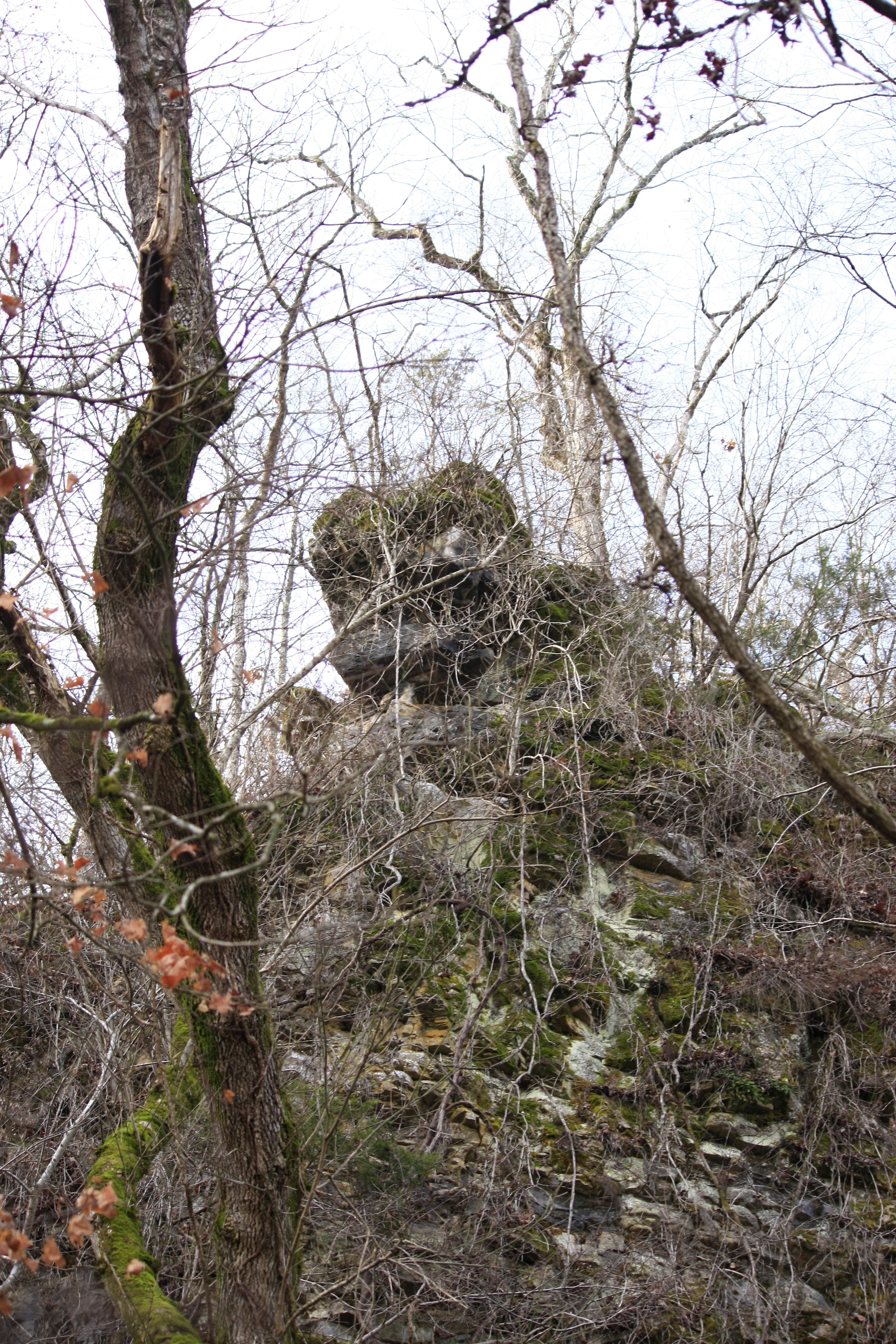
 |
overhang pedestal
|
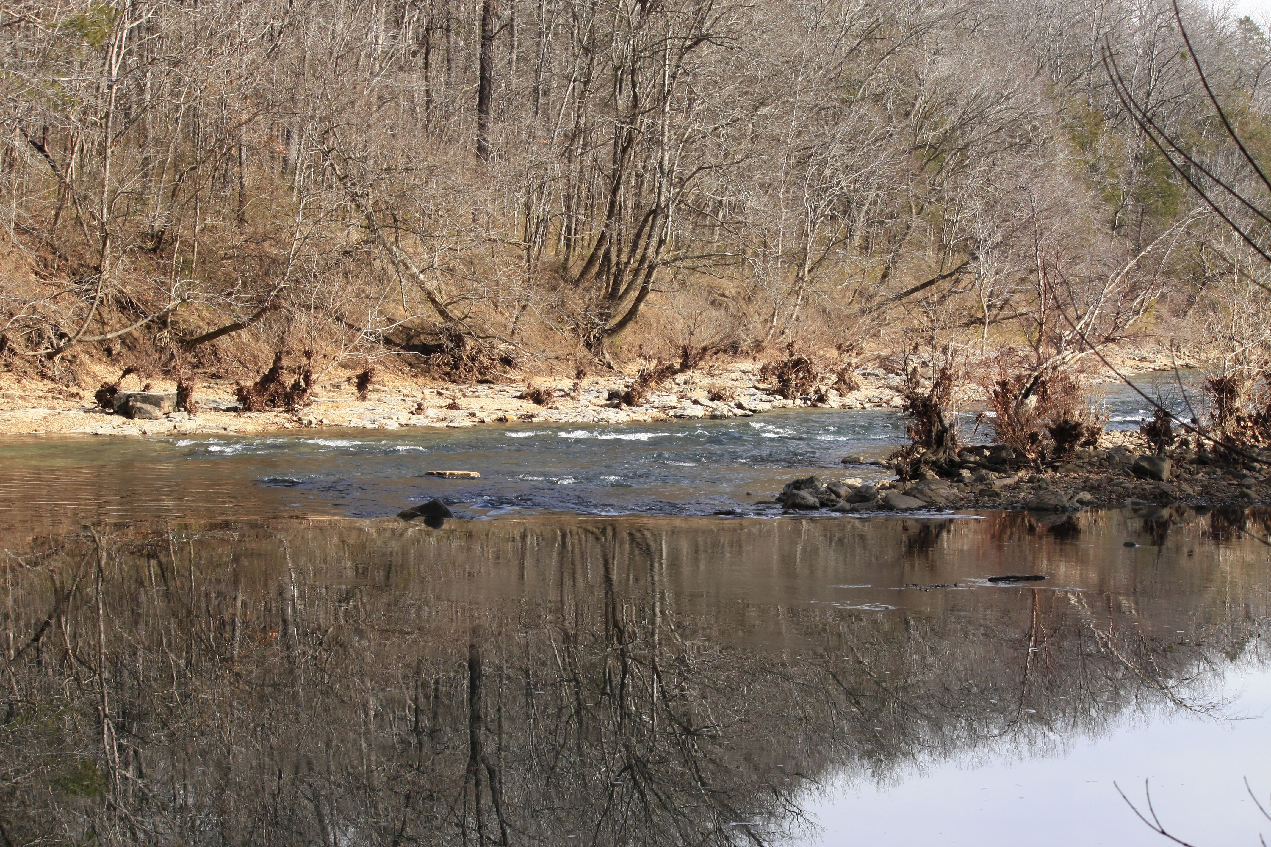
Up here on top of the bank I have a limited view through the bare trees
of Cave Creek Hole at a bend in the river under Clair Bluff with a gravel bar on the other side. Here at
the bend to the east is the bottom end of the hole which reportedly
extends upriver almost half a mile, from my vantage here on the bank the hole
looks quite deep.
 |
Cave Creek Hole on the Buffalo
|
Access down to the Buffalo from here would be difficult, I continue
south back away from the bank some, bushwhacking through the undergrowth of
young cane. Down through an erosion
gully clogged with downed trees I find a good trail on the other side, and I’m
now headed east between towering Clair Bluff to my right and Cave Creek below
the steep bank on the left.
 |
sweet reflections
|
Cave Creek here near its confluence with the Buffalo River flows almost
due west, while the Buffalo is flowing east on the other side of a narrow
gravel bar with brush and washed in deadwood scattered everywhere. Here the Buffalo has long rapids over 100
yards named Cave Creek Shoal.
 |
at the top of Cave Creek Shoal
|
On the other side of the trail Clair Bluff is equally impressive with tall
smooth walls and rock overhangs at the top and cedars near the edge, also a
wet weather fall which I’ll have to return after some good rainfall and check
out. Clair Bluff faces north so
naturally everything is damp and lush, the big slabs of rock that have broken
off the bluff are covered in bright green moss.
 |
Clair Bluff
|
The trail soon ends at the banks of Cave Creek flowing down from the
south, Clair Bluff also makes a 90° turn to the south along Cave Creek. Between creek and bluff is pretty narrow
maybe ten feet wide if I’m lucky, and no trail.
The bluff here at least gets lots of sun in the morning so it’s nice and
dry (and warm) as I slowly make my way south around and over some big, jagged rocks about 100 feet or less to a small cave at the end of the line.
 |
small cave
|
To enter this little cave, you would need to get down on hands and knees and crawl through the low opening. I don’t think so, I can imagine a bear sleeping
not too far inside. Peering in I can’t
see the back of the cave, so it is tempting, I sit on a rock here outside the cave and admire lovely Cave Creek with a nice little swimming hole below the cave.
 |
Cave Creek
|
I’ll call it Cave Hole, it looks plenty deep for swimming about 100 feet long, twenty to thirty feet wide with a small gravel
bar across the creek could be a great though remote place to hang in the summer. The downside though, getting here in the
heat and bugs and jungle of summer wouldn’t be much fun. See: (212 Cave Creek Trail) for my return to lower Cave Creek.
 |
at the river below the bluff
|
Only going a short way past the little cave this ledge between bluff and
creek gets even narrower, I turn around and head back around the point of Clair
Bluff and west on the good easy trail I came in on. Before reaching that eroded gully clogged
with dead trees, I notice a pink ribbon tied in a little tree to my left
where the trail heads up a little rise, I stay on the trail and avoid the gully.
 |
near the base of Clair Bluff
|
This obvious trail works out
great and I soon rejoin the old road near the big square rock I saw earlier
before reaching the river. Soon I come
to the faint road leading off to the east and decide to check it out. Not an actual road this is more of a volunteer trail created long ago by ATVs and horses but is still easy hiking.
 |
'beach' at top of Cave Creek Hole
|
About
200 yards later I come to a large campsite above the Buffalo, down through a
steep but easy little gully I’m at a nice gravel bar about 100 feet long on the
river. This the upstream end of Cave Creek Hole looks a lot
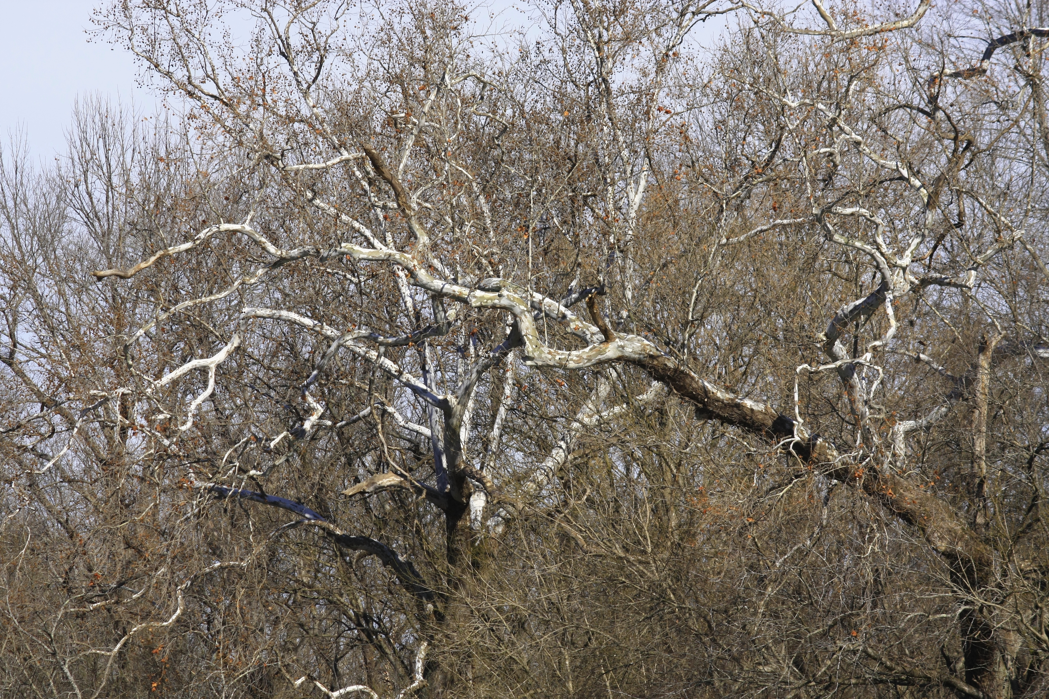
shallower, and has a very nice beach. Looking south Clair Bluff is visible at the river bend, and to the north are many white barked sycamores along the beautiful Buffalo River and another gravel bar about a quarter mile north. |
white barked sycamore
|
Back to the main road I
continue north gradually uphill. Around a curve to the west at the next road
intersection the road gets steeper for this last third of a mile back to
the parking area. This old road was
surprisingly clear and easy to hike, it is a great route to Clair Bluff, Cave
Creek and some nice swimming holes. My
entire hike there and back was 3.6 miles with 572 feet of elevation gain.
 |
bluff erosion
|
Cave Creek @ the Buffalo: Statistics Chart 137 The roads to the trailhead are in pretty good shape but can get a little confusing: Just south of the bridge over the Buffalo turn east off SR 123 on NC 4500 at the sign for 'Gene Rush WMA'. After 1.6 miles turn left onto NC 4260. Go about 3 miles on NC 4260 then turn left on NC 4267. Here you'll see the WMA Headquarters (maintenance yard), just over 2.25 miles on NC 4267 is the old road and parking area on the right. From SR 123 it's about 7 miles total to the parking spot/trailhead.  |
| base map before fair use alterations is property of USGS Topo--licensed under Creative Commons Attribution-Noncommercial-Share Alike 3.0 U.S. License |


Comments