Here it is the end of May and hiking season is rapidly coming to
an end, for a couple weeks now with temps in the high 80’s it’s just been too hot to even think about hiking. Day
before yesterday a big storm went through dumping over 2 inches of rain and
plummeting the temperatures 20 degrees.
So of course, today we’re going hiking hopefully with some waterfalls along the way, it might be our last until fall.
 |
trailside peaches
|
After some thought I decided to
try an old road that heads north off Parker Ridge Road down to waterfalls
on Rock Creek. My theory being; since Rock Creek is popular with ATV's these old roads should be fairly clear of the undergrowth that gets
pretty thick this time of year. Another
reason for choosing this particular route is because since today is Saturday
and a holiday weekend, a relatively unknown old road should be a safe bet to avoid the crowds.
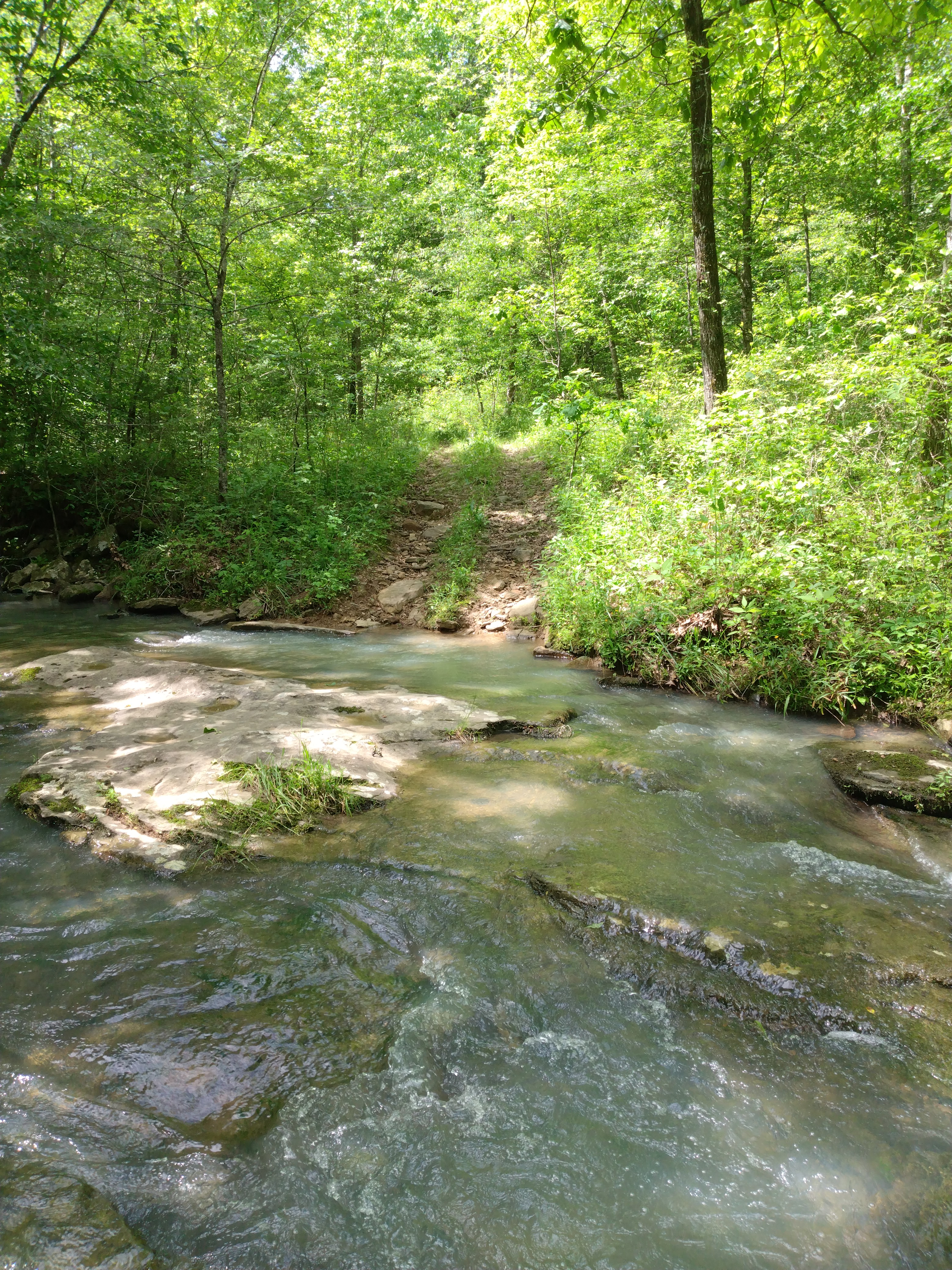
 |
little creek near crossing
|
Maybe I should have put two and two together; an old road overrun with ATVs on a
Saturday is a lot worse than a bunch of hikers in the woods. The obvious
reason not to do this hike is because the normal route to these falls, hiking up Rock Creek from the parking
area off City Rd. 311 is a lot shorter hike and only a fraction of the
elevation gain, but hey, you never know until you go. For our previous visit to the Rock Creek area see: (85 Rock Creek Bluff).
 |
Rock Creek
|
Anyway, from our parking/trailhead in front of the Forest Service gate we hike down old road FR 92104A, which is pretty grassy for an ATV trail, evidently this road doesn’t get much traffic and that’s fine, on the downside the ticks are thick.
We are stopping every few minutes to brush off ticks, we
sprayed our pant legs and boots liberally with bug spray that doesn’t appear to have any
effect.
 |
Rock Creek trail crossing
|
The first thing we
notice (besides the ticks) along this road is blackberries everywhere just
starting to ripen, come back in another week and pick to your hearts
content. Also for the fruit lover, just
over half a mile on the left side of the road is a peach tree loaded with
fruit, but it’ll probably be towards the end of June before these are ready to
eat. And finally,
there are a lot of wild grape up here near the top of this ridge, all things considered a fruity jungle.
 |
Rock Creek Cascades
|
Rarely do we see any tire tracks, but we do see lots of deer and raccoon
tracks, it doesn’t look like this road is very popular with the ATVs. If you want to check it out in your 4-wheeler
you had better bring the chainsaw and machete, oh-well so much for my theory of
a clear route, but it’s not bad
really, we never even once consider turning around.
 |
waterslide cascade
|
Downhill about 200 yards past the peach tree is an old campsite on the right that doesn't appear to have been used in years, then a quarter mile further an old road FR 92104C heads east, we
continue mostly north on this ‘main’ road. We've been gradually heading downhill since the start, here at this
intersection the descent increases
but I still wouldn’t call it ‘steep’ as we begin winding our way down off the
ridge. Almost to the
bottom this old road ends on a well-used ATV trail, we can go left or right either way is downhill.
 |
Rock Creek Falls
|
I decide left, to the west since the plan is to visit
Johnny Trail Falls first then work our way upstream to visit the falls on Rock
Creek before heading back the way we came.
This is more like it, the trail is great, nice wide and mostly clear
of any vegetation. No ticks down here,
we’re really enjoying this easy trail and soon come to a gorgeous little creek
which we cross, around a turn to the west the sound of
falling water starts getting louder, I assume we’re listening to Ava Jane Falls on Rock Creek below.
 |
aka Upper Rock Creek Falls
|
The sound is a tease as we can’t see anything through the jungle, we stay on the road, which soon takes us through a beech
forest, with large trees on both sides of the trail that swings around to the left (south) and downhill some more. At a little
feeder stream, downstream is Johnny Trail Falls almost a quarter mile. Looking at the road past the crossing it
appears to continue southeast upstream away
from the falls. Hmm, to cross or not
to cross, this creek isn’t one we can just rock
hop over to the other side. The
crossing looks easy, but we turn around assuming this road
isn't taking us to Johnny Trail Falls.
 |
Ava Jane Falls
|
Disappointed over not seeing Johnny Trail, I have renewed
determination to find a way down to Rock Creek as we head back up the road. Past
the big beech forest and before crossing the gorgeous little stream we leave
the road at a curve to the south and head downhill along the little stream
to the northwest through open woods. Along the way we see a couple rock piles before coming
down alongside the stream. Crossing the
stream, I notice what appears to be an ATV road, sure enough we’re back on a road, and just 20 feet from Rock Creek.
 |
Ava Jane from the bluff's edge
|
Our first step into Rock Creek is cold but not as cold as I expected, it feels good actually. We don’t ‘cross’ the creek, which is
20-30 feet wide, instead we walk downstream in
Rock Creek on solid bedrock, and it’s just beautiful. Starting above Rock Creek Cascades we pass the two beautiful separate cascades on our way downstream.
 |
bushwhack along small creek
|
The first a short traditional style cascade
with several drops, then the second a twisting slot waterslide looks like fun in an inner tube. There are a lot
of dry sections of flat sandstone in the mix along our way downstream and when
we are in the water it’s not deep
just above our ankles, the current is quick, but the sandstone bedrock isn’t
slippery making this a very enjoyable stroll downstream.
 |
Ava Jane grotto
|
At the top of Rock Creek Falls we make our way over to the bank on the
north side and climb down the rocks to the base of the falls, then back in the
water which is a little deeper here but what gets our attention right away is
how slippery the bedrock
is, we gingerly creep across below the falls back to the south bank of Rock
Creek. From here we have a great view of
Rock Creek Falls, not very tall at about 10 feet but none the less
spectacular.
 |
scenic Rock Creek
|
Probably
thousands of years ago a huge slab of rock broke loose and collapsed in the
creek, creating Rock Creek Falls, now with some of the water falling behind this giant slab
it is like a ‘backwash’ behind and under the falls, not a place you want to get stuck in a kayak. But the
overall effect is visually stunning.
 |
above Rock Creek Falls
|
Since the creek became slippery for some reason we change back into our
boots and continue downstream on the south bank towards Ava Jane, it’s a little rough along here with lots of poison ivy, but not far we
soon arrive at the top of Ava Jane Falls. And a dead-end maybe we should have stayed on the north side of the creek.  |
easy hiking down Rock Creek
|
Ava Jane Falls a little taller than Rock Creek Falls maybe 15 feet total but has a whole different personality.
On the south bank at the top of the falls it’s hard to get a good
view, the slope down to the base is steep, slippery and
covered in poison ivy before reaching a rocky drop-off with Rock Creek straight down below. On the other side of the creek starting at
Ava Jane and wrapping around to the northwest is a long shelter/grotto,
the whole scene is gorgeous. |
Blue Toadflax (I think?)
|
We can’t really go any further though, so we try to get some pictures
from here near the top of Ava Jane on this slippery slope covered in poison ivy. Kat suddenly slips on the muddy slope,
between the hiking pole in her right hand and me grabbing hold of her left elbow she somehow regains her footing
before falling into the poison ivy, or worse yet the rocks and creek
below. We turn around and head back cautiously to the base of Rock Creek Falls. |
Rock Creek
|
We bushwhack
through the woods back to the ATV trail. This works out fine we find three more larger rock piles along the way,
reaching the trail we turn right, away from Rock Creek. Soon we hear voices and children playing...
it’s a large group of ATVs parked at a road intersection, these are nice big
side-by-sides and there must be 6 or more of them. I try to spark up a conversation, they’re
‘amazed we hiked all the way back
here’.
 |
perplexed?
|
We turn right
uphill back toward the seldom used road we came down. Another 200 yards we're at the intersection
with the old tick infested road, it’s all uphill back to the truck at
Parker Ridge Road, almost a mile and a half to the southeast. Even with the ticks, we still had a great day hiking to some spectacular water features on Rock
Creek, we hiked for 4.9 miles and an altitude gain of 898 feet. Maybe next trip we'll make it to Johnny Trail Falls.
 |
why do you think it's named 'Rock Creek'?
|
Ava Jane Falls on Rock Creek: Statistics Chart 95 Parking/trailhead is in front of a Forest Service gate north off Parker Ridge Road (NC 7410) a little over 2 miles southwest of Robinson Road (FS 1202C), or about 3.5 miles northeast up Parker Ridge Road from the intersection with Big Piney Road (JC 5881). For more information on Parker Ridge Road see: (42 Parker Ridge).
 |
base map before fair use alterations is property of USFS Forest Service-licensed under Creative Commons Attribution-Noncommercial-Share Alike 3.0 U.S. License
|


Comments