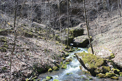
I have wanted to see
Big Creek Cave Falls for a long time but wasn't sure if I knew where it
was. After all there are two different
creeks named Big Creek in the Buffalo River drainage, and there's the Left and
Right Forks and well, I was a little confused. But after some research Big Creek was
actually pretty easy to get to.
 |
Big Creek Cave Falls
|
We start our hike
at a Forest Service (steel cable) gate. There are two gates and either one
works as a Trailhead. Past the gate, heading south down an old road we soon
come to Left Fork Big Creek which is flowing pretty strong. I thought we had
come prepared for creek crossings; I had read about these 'hillbilly waders'
aka 'El cheapo creek waders'.
 |
old relics
|
Simple to use and seemingly a great idea, you
just slip a heavy-duty trash bag over each boot, hold them up around your knees
with bungee cords and head across the creek. Well as the saying goes you get
what you pay for. After just a few steps they begin leaking and by the time we
get up the south bank our feet are completely soaked. Oh well, you live, and
you learn.
 |
homesite ruins
|
We continue south hiking on the old road, much of
this hike is on old roads that crisscross the area. This particular
section of road doesn't get much use and is a little overgrown and muddy in
spots. But that doesn't last long, we soon come to an old homesite. Even before
seeing the remnants of the house which consists of foundation stones,
fireplace, chimney, and a nearby root cellar, we notice a junk car. Then
another car, and a truck, they're all over, in the front yard, the side yard, even
across the road.  |
another old 'classic'
|
Continuing on a little way downhill past the old homesite we arrive at a cattle guard across the road.
This is an important trail Intersection, the
road to the south is the best way to get to most of the amazing things to see
on this hike. The road to the west follows Left Fork Big Creek downstream, then
through some hay fields and eventually out to that second gate I mentioned at
the top.
 |
Right Fork at crossing
|
That's the way we'll head out, later, but first south to the
really good stuff! The road follows above the east bank of Left Fork and soon comes to where there was a little landslide a few years
ago. We scramble up and around the landslide area and are back on the road
pretty quick. By now (although we can't see it) we're getting close to the
confluence of Cole Creek and Wolf Creek which together form Left Fork Big
Creek.
 |
near bottom of Cave Creek Cascade
|
A little farther we cross Wolf Creek which is almost dry today. Past
Wolf Creek we leave the old road, head west crossing a river rock field,
which is just upstream of the confluence. Today this route works just fine, but
during high water, may be impassable.
 |
Big Creek Cave Falls
|
We soon come to Cole Creek and scramble up a low bank on the other side, here we find a well-worn
trail and head north. Then a small drainage to our left with a steep trail up the south side of this little creek, and after maybe a hundred yards
arrive at the base of Big Creek Cave Falls. This is an incredible waterfall,
flowing out through the mouth of a cave.
 |
Right Fork Big Creek
|
After a little rest and a few snapshots while marveling
over the beauty of Big Creek Cave Falls, we continue around a short steep ridge into
another little creek drainage just to the north. This one is not as steep and much
easier to follow up along Cave Creek Cascades to the amazing little cave from which the creek emerges. We poke around some at the cave entrances but don't actually go inside. |
at the top of Cave Creek Cascade
|
From Cave Creek Cascades
we continue north a short way. But the trail soon evaporates so we turn around and head back the way we came to the cattle
guard intersection. Here we go west towards the field and the other gate back
at the parking area.
 |
Left Fork Big Creek
|
Just a hundred yards or less from
the cattle guard is a short trail (left) down to the creek and another
amazing waterfall. Rock Peninsula Falls is a huge house size boulder right in
Left Fork Big Creek. When the water flow is high, it falls off three sides of
the boulder, thus the name 'Rock Peninsula Falls'. |
Rock Peninsula Falls
|
From Rock Peninsula and back up on the trail, we follow Left Fork downstream to our second wet crossing, this one not bad,
we're able to rock hop across and stay mostly dry. Then through a couple hay
fields to the last crossing. This time it’s Right Fork Big Creek another easy
rock hop. Just across the creek is an old barn on the left, where we begin uphill on the
old road past another homesite. And at the top of the hill is that 'other'
gate and the parking area.
 |
shallow creek crossing
|
Big Creek Cave Falls: Statistics Chart 9 The whole Big Creek area is
a wonderful place to explore, today we hiked 3 miles in an hour and 45 minutes but spent
over 5 hours total in this great little piece of the Ozarks. There are lots more
waterfalls and caves here to see, so we'll definitely be back, for our next visit (with more water, driving directions and a map) see: (43 Wolf Creek Cave Falls).


Comments