Posts

124 Hiner Hole Two

Image
   Today’s plan is to drive down NC 2890 past Hiner Hole to check out the other holes farther up-river that we didn’t get to when we were here a couple weeks ago, namely Dry Ford Hole and Miss Hickman Spring Hole.  About a mile in on NC 289 0 we notice the road seems worse than last trip here, really tore-up.   We soon find the culprit; the county road grader is working on the poor road making it even worse.      We wait while he pushes some cedars up the bank on the right then pulls off the road enough that we’re able to squeeze past.   Well, the old road down to Dry Ford Hole isn’t where the map shows, in fact we find no road at all, farther along are a couple old roads both with locked cable gates.   Oh well, with a name like ‘Dry Ford Hole’ we weren’t expecting much anyway.      Down the road another mile at a sharp right turn is an old road to the left going down to ‘Miss Hickman’s’ which has not one but two locked g...
123 Toes In the Sand

Image
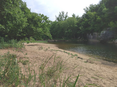
     Always looking for new swimming holes, I often use Kenneth Smith’s ‘Buffalo River Handbook’ along with four different maps of the Buffalo River region, all the maps are different as far as location and existence of roads and trails.   Transposing swimming hole locations from Ken Smith’s book to the  maps, I  have ‘found’ four more possibly accessible swimming holes upriver from Pruitt.      Today we’ll hopefully find one that’s a nice peaceful place to relax on the river.   Only one map shows any roads leading back to these swimming holes, and all these holes are farther upriver  than any hole we have visited in the past.   So, hopefully we will be able to get to one having enough water to swim, I’ll keep my fingers crossed.      Travelling south on Highway 7 just north of the river before coming to the bridge is NC 2890 off to the west (right), we turn here on the paved road.   The pavement only last...

122 Arnold Hole

Image
     Today is forecast to feature ‘blistering heat’ and the rest of the week is going to be even hotter.  So where do you draw the line, when is it too hot to even go swimming?  Kat is of the opinion that it’s going to be too hot today to even be outside and it’s a bad idea that we will regret.  Well,  we’re going anyway, and with the temperature already 90° at 9:00 as we’re pulling out of the driveway, it appears the weather forecasters got it right for today.      We head south on Highway 65 as the temp soars towards an eventual high today of 102°.   Before crossing the Buffalo River,  some maps show an old road going down off the highway to Lower McMahan Hole under the highway bridge at river mile 95 .  Although I slow down, we don’t see anything resembling a road just high grass and brush, we strike McMahan Hole  off the  list and continue across the bridge to Grinders Ferry.      ‘The Sw...

121 Tie Chute Hole

Image
     While looking at maps for new swimming holes to check out, I notice three holes relatively close to Spring Creek Campground which is also a new place for us to explore.   My maps don’t show any roads to these three holes but we’re going to give it a shot , we also have some back up plans ‘just in case’.    We turn off Highway 14 onto west bound Spring Creek Road (SC99) about 4 miles south of the Buffalo River bridge and less than half a mile north of Cozahome Road.      Spring Creek Road isn’t bad a typical dirt and gravel road.  Mostly level for the first mile then down a moderately steep hill passing Spring Creek Trailhead for the BRT on its way to the campground along the river at the bottom.    ‘May Cemetery’ is about 100 yards off Spring Creek Rd. close to where the road bottoms out, and this is where we look for an old road heading back to the cemetery and hopefully either Slough Hole or Spring Creek Hole both downs...