Back to the Buffalo to do more exploring, this time upriver
from Pruitt about half way to Erbie. A
few years ago while out scouting for
swimming holes off NC 2890, we found only one swimming area that was close enough to hike in summer’s heat.
But we did find some old roads (with gates) that seemed inviting as
possible hiking routes. The weather man is predicting today to be the ‘pick day of the week for getting outdoors’ so it's back to the Buffalo.
 |
beautiful scene on the Buffalo River
|
At a sharp curve with a heavy wood gate I park off the road being careful
not to block the gate. Going south beyond a second gate on my right are
some ruins, first a concrete block foundation that isn’t very wide, hard to figure out what this might have been. But just
behind is a larger poured concrete foundation obviously once a house. Then the road enters a big field where the roadway becomes a trail
before vanishing completely. |
| big hay field on ridge |
 |
fall berry bush
|
Not a problem though, this huge field must've been cut late in the haying season the green grass is only
about three inches high, very easy hiking. Making my way downhill along the edge of the field for about
five hundred yards to a very big oak tree not far from
the edge of the field. I head west into
a smaller field and find a trail marker for Old River Trail, which goes right past the
big oak on the right and a little overgrown pond left, then back out into
another field. |
big oak dwarfs everything else
|
This big field hasn’t been cut this year, the golden
grass is about two feet tall, the ORT fades away pretty quick. I continue gradually downhill now mostly
north staying close to the edge of the woods.
Even though the grass is higher this is still very easy hiking, at the bottom corner of the field the ORT re-appears leaving the field down
through the woods to the Buffalo River. |
| ORT evaporates in the fields |
 |
un-cut field
|
Getting closer to the river there are a lot of big trees piled up all
along the bank, and of course the ORT disappears again. I make my way through downed trees along a low bluff down to the river. Maybe I can see where the trail comes out on the other side, but I could be wrong,
the water doesn’t look too deep. A
crossing here wouldn’t be bad but I have no desire to get my feet wet today (breaking in a new pair of boots). |
| ORT river crossing |
 |
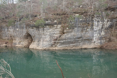
High Dive Bluff
|
I head back through the driftwood
and lots of soft sand up to the top of the bank, now following the river
downstream and staying at the edge of the field.
After 300 yards or so this field ends at a little gully, finding a way
across into the next field at a game camera strapped on a tree. Noticing bluffs through the thin border
of woods between field and river I decide to check it out. |
| sycamore leaning over river |
 |
reflections at Miss Hickman Spring Hole
|
Getting to river level is more of the same: big trees piled up
along the bank, lots of soft sand underfoot.
Down through a mountain of sand and debris of brush I’m
on a thin gravel bar looking across at a beautiful scene of bluffs and
river. The bluff is maybe twenty feet tall and has a flat ledge rock on top that hangs out over what
appears to be a deep swimming hole, hmm High Dive Bluff? (user beware
diving is dangerous). |
debris in the trees, sand on the ground
|
For the next 200 yards downstream I’m able to stay down close to the
water walking in the sand with only a few downed trees to navigate around. Past a big Sycamore leaning way out over the
river is a huge pile-up of deadwood which forces me to climb back up the bank and
into the field, but not for long. |
| another gorgeous swimming hole under the bluff |
 |
slanting boulder near mouth of Sawmill Hollow
|
Now in a low flood plain with timber debris everywhere and piles of
brush 10-12 feet high wedged against trees still standing, it’s all sort of surreal, but I’m still walking in soft
sand, I head back to the river.
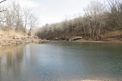
Here is the location of ‘Miss Hickman Spring Hole’ but the almost 1500
foot long swimming hole doesn’t look to be more than about three feet deep, we know though, it's always deeper than it looks.
 |
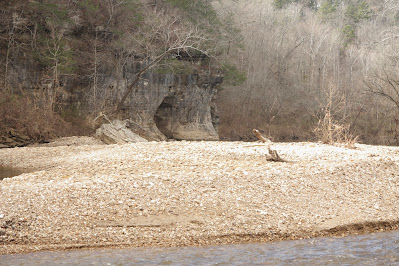
| an island of gravel |
 |
Porch Bluff
|
Briefly back up on top the bank in the field, then right back down 200 yards later I’m at Porch Bluff which is only 10-15 feet high but the
flat top hangs out way over the river, canoes can glide by under the ‘porch’
another beautiful setting to be sure. Under
Porch Bluff the river looks plenty deep to swim. Just downstream at the mouth of Sawmill Hollow
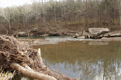
I recognize the big slanting boulder that years ago when hiking on the BRT had
two big trees deposited by flood waters laying on top (see: 41 Cedar Glade to Adair).
 |
| Porch Bluff beyond remains of a mangled tree |
 |
slanting boulder and downstream
|
From here I’ll head back up the hill all the way to the top,
leaving the soft sand behind. It’s
mostly across big open fields of short cut grass, all very easy hiking and I
realize this entire hike has been a bushwhack except for about a hundred yards
on the Old River Trail. But possibly the
easiest bushwhack I've ever done, the
mileage was 2.7 with 250 feet elevation gain, easy and 100% enjoyable. What a way to spend the ‘pick day of the
week’.
 |
more easy hiking on the way back to the top
|
Miss Hickman Hole: Statistic Chart 185 From SR 7 just north of the
Buffalo River bridge take NC 2890 (4-WD recommended) west for about 5 miles to where the road makes
a sharp turn to the right at a heavy wood gate.
Park here but don't block the gate, there's room for maybe
three vehicles.
 |
base map before fair use alterations is property of USGS--licensed under Creative Commons Attribution-Noncommercial-Share Alike 3.0 U.S. License
|


Comments