When we got up this morning, I was pleasantly surprised by temps just
above 40°, I decided right then to go hiking.
Heading down to Steele Creek Campground, I pass Centerpoint Trailhead
around 9:00, the trailhead parking area is already completely full. A lot of others apparently agree, today will
be a great day for a hike. Above the canoe launch area at Steele Creek is a big parking area, I park here close to Steele Creek and notice I’m all alone.
 |
Big Bluff on the Buffalo
|
The only other vehicle in sight is a truck
with horse trailer across the big field at the horse camp. As I take my time gearing up for the hike four more cars arrive, I knew I wouldn’t be
alone for long, today is Saturday. After brief conversations with arriving hikers and a park ranger
who just transferred here from Colorado but doesn’t know much about the BNR, I
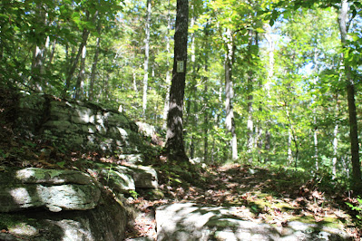
head south to the corner of a fence. Entering the woods above Steele Creek, I find a faint trail
that I try to follow south between fence line and the steep creek bank. Not 100 feet later is a nice cave opening
up on the bluff across Steele Creek, it doesn’t look like it would be very easy
to climb up about 30 feet from creek to cave.
 |
small cave in bluff
|
This faint trail is more like a ‘bushwhack’ when I can find it in the thick undergrowth, just keep going
south above the creek. After the fence line turns west
and I pass under the powerlines, this little trail heads uphill pretty steeply
then ends at the BRT. This is more like it, the Buffalo River Trail is in great shape and
soon comes alongside a wet weather fall.
Then 100 yards further a flat area in the woods with a trailside
campsite. The trail soon descends to Steele Creek.
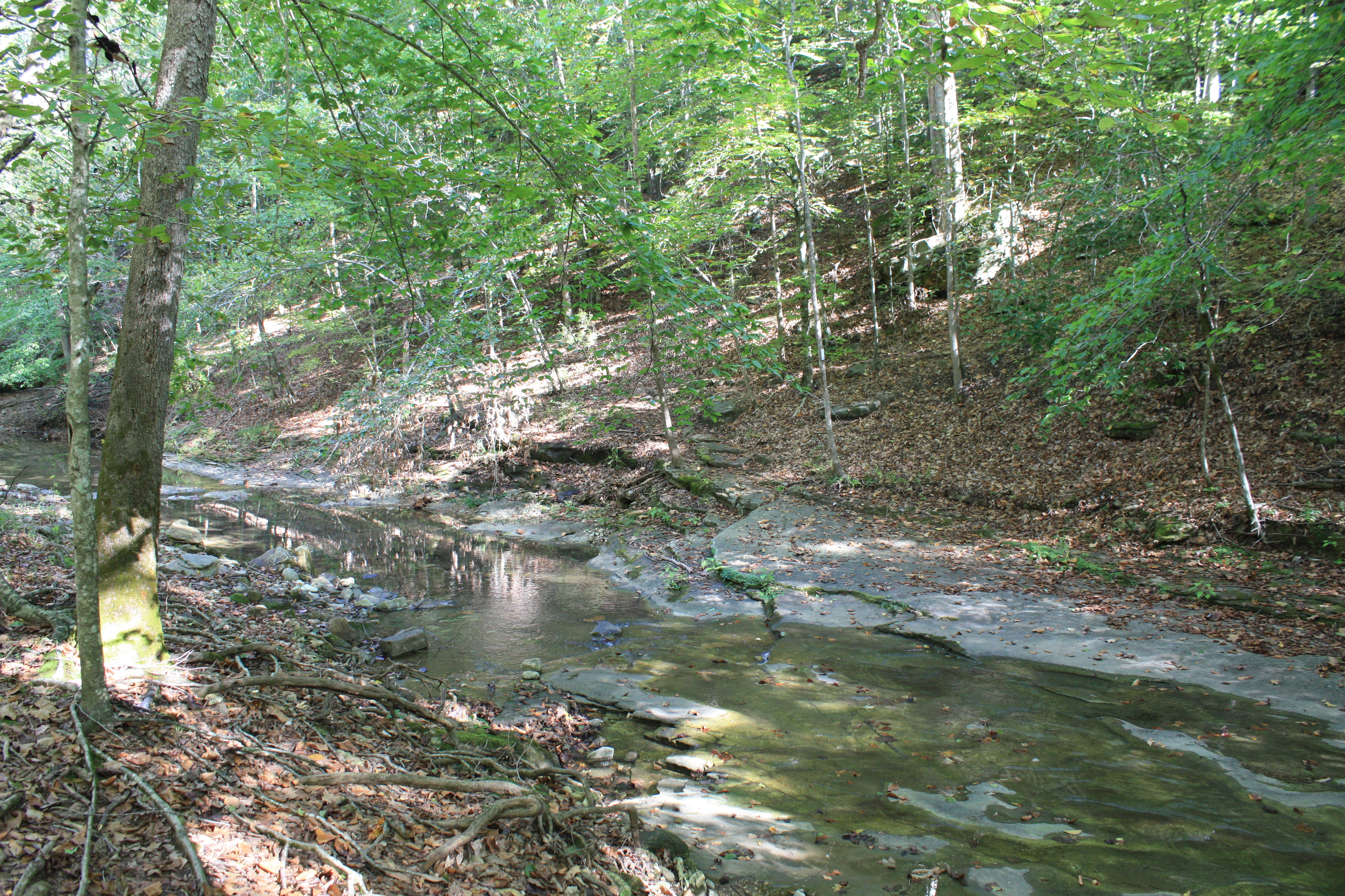
After crossing the BRT turns right and goes back uphill to
another nice wet weather fall, this
one with three tiers.
 |
Steele Creek near crossing
|
Here the trail turns south, and climbs up natural steps over slick wet rock. At the next turn east is a nice viewpoint of Steele Creek looking
south below the trail. Still gradually
heading uphill I turn north to more natural stone steps and a nice upper
and lower waterfall about 60 feet tall total. The trail continues up northwest before swinging around to the
northeast at a nice trailside campsite.
A hundred feet farther the BRT climbs through some big rocks at the
beginnings of a bluffline.
 |
clean and easy hiking on the BRT
|
Continuing uphill around the next little side drainage I arrive at a
rocky point called Steele Creek Campground Vista aka Roark Bluff Vista. This is a great spot, everyone I’ve met
on the trail (so far) are all here enjoying the view and resting up for the
hike back to the campground. Evidently
this is as far as most people go before returning. I keep going up the trail after a break enjoying the fabulous view to the
west.
 |
rock passage
|
So far the hike has been all uphill, but nothing steep, just a steady pretty easy climb. Just past the Vista for about a hundred yards
is the steepest trail encountered yet. After the short ‘cardio workout’ the BRT
levels out near where the trail rounds Fisher Point then begins the long gradual
descent. As I approach Fisher Point, I
look for any signs of the old Fisher Point Road heading off to the right uphill, but I don’t find anything (see:
105 Fisher Point Road).
 |
@ Steele Creek Campground Vista aka Roark Bluff Vista
|
Still heading north and downhill I pass three small sinkholes spaced
about a hundred yards apart then round a big sweeping bend, now I’m headed
southeast. The trail levels out for the
next half mile, and while the trail follows on top a 400-foot bluff above the
river there are occasional views of Big Bluff through the trees. Hard to photograph now, but come back in the
winter without the canopy of greenery for some great pictures of the big bluff.
 |
Roark Bluff on the Buffalo River
|
Farther back in the woods is a trailside camp, complete with
occupants. We exchange greetings, the
two campers tell me I’m only the second person they have seen this morning and
ask where I’m headed. We discuss Beech
Creek Trail up ahead about half a mile and my planned loop hike back to Steele
Creek Campground. They intend to do the
same loop but are only hiking about two miles a day with their focus on ‘camping’
along the way.
 |
early autumn color
|
Continuing along the BRT now heads more in a southerly
direction and starts downhill again.
The trail weaves in and out of little side drainages, in the
second is a pretty tumbling cascade, with more water would look
great. In the next little drainage
a nice 12-15 foot waterfall just below the trail which could also in need of more
water.
 |
Big Bluff through the trees along the BRT
|
Two hundred yards later in a pretty area of open woods are a couple natural stone benches just off the trail, and
100 yards further more natural stone steps down to the next level. Here I notice a BRT blaze on a tree, one of
only a few I’ll see all day. Then in
another 100 yards the signed intersection of the Buffalo River Trail and Beech
Creek Trail, I turn left downhill, now on Beech Creek Trail.
 |
trail signage
|
It’s gradually downhill under a quarter mile to Beech Creek after
passing a huge boulder between creek and trail. Near the bottom off to the
right is a beautiful setting on the creek with many giant boulders and bluff, choking Beech Creek. Right in the middle of this gorgeous area is a nice campsite complete with stone furniture around the fire-ring, I do a
little investigating, while in the campsite a couple hikers catch up to me.
 |
approaching first crossing on Beech Creek
|
I've heard them
behind me talking for some time, we walk
down the trail to the first Beech Creek crossing together, they are hiking the
same ‘loop’ route as me. There isn’t
much water flowing in Beech Creek, she says, “I don’t want to get my feet wet”, I say, “well just wait till you get to the Buffalo River” and he just says, “shhh”. Past this first of three easy
creek crossings are a couple more campsites, it’s about a quarter mile to the
Buffalo River.
 |
Buffalo crossing #2 and Big Bluff
|
On the gravel/cobble banks of the Buffalo River near the mouth of
Beech Creek are a bunch of folks whooping
it up in the water just downstream, I find a log
to sit and change footwear for the crossing which is only 8-10 inches deep, the cool river feels good, I
have five more crossing to go before reaching the truck back at Steele Creek.
 |
glimpse of Big Bluff through the trees
|
Up through the eroded riverbank in less than 100 feet Beech Creek
Trail ends at Old River Trail, here I turn left following the Buffalo
upstream. The first thing I notice down
here in the floodplain is encroaching grass and weeds trying to choke
out the trail, but between horse and foot traffic this popular trail is easy enough to follow. After a few
hundred yards is a rock cairn at an intersection, the end and
bottom of the Goat Trail.
 |
Goat Trail along the face of Big Bluff
|
Still on the ORT, I come to a fork in the trail and follow the
right fork which of course is the wrong choice.
This trail soon disappears in a large area of driftwood debris or flotsam, I make a beeline across this
mess straight for the river just 100 feet away and intersect the real trail along the way. Here’s my second river crossing with two
hikers standing on the bank, I sit on a good sized rock to change back
into the sandals.
 |
signpost at trail junction
|
The two hikers have a car parked up at Centerpoint Trailhead from where they came down the Goat Trail, an elevation change of over 1100 feet. They ask where does
this trail go farther upriver? I tell
them, eventually to Ponca after going through Steele Creek Campground first (see: 68 Ponca to Steele Creek). They gaze across the river at the ORT with a
look of dejection and explain “we’re camping at Steele Creek” they slowly turn
and head back to the Goat Trail and the long uphill trek to their waiting car.
 |
Big Bluff @ river crossing #3
|
Crossing two while pretty wide is uneventful, more of the same 8-10
inches deep over gravel and small round river rock. On the other side I decide to leave the
sandals on since the next crossing doesn’t look very far on my map. Along the way I come to a small
trailside campsite, then 100 yards further a faint trail down to the
river at Big Bluff Hole. Which today
sounds like the happening place for a pool
party.
 |
wide tranquil Buffalo River
|
Another couple hundred yards is the next intersection, a trail goes up the steep rocky hillside to an old barn that marks the site of the
original Centerpoint Schoolhouse. I continue on though, still in sandals I hope
the next crossing is soon. Down a
short hill and a little over 100 feet is crossing three, more of the same, but
I will say I’m glad to have my walking stick for all these river crossings.
 |
interesting Beech tree
|
On the other side of the river sitting on a rock changing back
into my boots (my feet will really appreciate this), I realize this spot has a premium view of Big Bluff back to the
northeast. I hang-out awhile taking
pictures and watching the little ants
high above traversing back and forth on popular Goat Trail. Now the ORT is headed mostly west, in many places I can tell
this was once a road. With lots of low rolling hills in the river
bottomland this was someone’s farm a long time ago. I keep looking out in the open woods for
any sign of a homesite, about half a mile later come to river crossing
four.
 |
ruins of concrete and stone
|
Still heading west I believe the trail has left the old roadbed, it’s
easy going just more erratic in direction eventually heading south. Up ahead maybe 30-40 feet I notice two
deer coming down the hill about to cross the trail when they see me and
make a sudden about face and bound back up the hill. Watching them go, I see
concrete ruins possibly an old house, another twenty feet or so down the trail
is a faint trail up to the ruins.
 |
small wooden shed
|
I take a little side trip to check it out, with some stonework out in
front this concrete structure with a domed ceiling has no windows, just a doorway. At first, I assume this was
probably a root cellar but then I notice the galvanized tin flue through the
roof in the back and decide it must be a smokehouse. The faint trail appears to continue up a
little rocky gully and so do I. Not far
I find a small wooden shed with tin roof, this also has no windows. I look around some but not finding
anything else head back down to the ORT maybe 200 feet away.
 |
@ river crossing 4
|
In another hundred yards is the river at crossing five, on the
other side maybe 100 feet is a faint trail left down to another swimming
spot called Bud Hole. I stay on the ORT
which gradually swings to the south and passes through an area with some very
big beech trees. Another quarter mile
south I see an occupied campsite well off the trail back near the river under a
bluff...very nice.
 |
'Saturday in the Park'
|
I know I’m getting close to the sixth and final Buffalo crossing but
before getting there is one more faint unmarked trail intersection with what’s
known as Roark Bluff Trail. A hundred
yard further I’m on the banks of the river and before crossing I see a swimming
hole with two rope swings tied in trees right at the mouth of Steele Creek,
I’ll call this Steele Creek Hole.
 |
near Buffalo crossing 5
|
Across the river maybe a hundred yards up the trail I finish this
7.2 mile hike with 1117 feet of elevation change back at my truck in the big launch
area parking lot. Eleven hundred feet of
elevation change seems like a lot but overall, this was an easy hike, and today
truly was a great day to be outdoors in the Ozarks.
Steele/Beech Creek Loop: Statistics Chart 148 Steele Creek Campground from SR 43/74 intersection take SR 74 across the river and up the mountain about 1.4 miles to Steele Creek Campground under the big entrance arch, follow paved Steele Creek Road down hill. When the pavement ends continue through the big field northeast to the canoe launch area and big parking area (S1). Or you can come in off SR 7, at the Little Buffalo River in Jasper take SR 74 west about 12.7 miles passing through Mt. Sherman and Low Gap along the way.  |
| base map before fair use alterations is property of USGS--licensed under Creative Commons Attribution-Noncommercial-Share Alike 3.0 U.S. License |


Comments