Posts

Showing posts from July, 2020

61 Sand Hole

Image
      Sand Hole is a bit off the beaten track, downstream of river mile 101,  so let’s see if we can find it.  At St. Joe we go east on Osbourne Road, which is paved for about 6 miles.  Then at a fork, it’s a left on Tomahawk Slab Road, Osbourne continues south to Gilbert.  On Tomahawk Slab just over half a mile to yet another fork, we take the right onto Mercy Lane, then less than half a mile, right again on Sand Hole Road.  We would have never made it, if not for the guidance of Trails Illustrated Map/Buffalo River East.     Each road on this route is worse than the one before, without high-ground clearance and 4WD you might make it, but I wouldn’t suggest trying.  As we creep down Mercy Lane and then Sand Hole Road, I notice we have a couple vehicles behind us, the first a new Jeep Rubicon 4DR, and behind them a 4x4 truck like ours.  We slowly crawl our way to Sand Hole at the end of the road. Sand Hole      The parking area is big enough for 6-7 cars, there’s nothing here but a s

60 Shine Eye

Image
       Our plan this morning is to drive to Baker Ford and swim in Baker Ford Hole  near the canoe landing but arriving at Baker Ford we change our minds.  Baker Ford Hole is big, stretching almost half a mile but there is no beach, just a steep muddy bank into the water and that isn’t very appealing.      We decide to try Shine Eye instead just about 5 miles farther south (from St. Joe) on Highway 65, turn east on Shine Eye Road just north of the river.  The dirt road is in good condition all the way down to Shine Eye a little over a mile at river mile 96  and passes a couple hiking (or horseback riding) trailheads along the way to the bottom.      The parking lot is pretty big, with room for probably 20 cars in the grassy area, and there are already five or six here when we arrive.  Also at the parking area is a vault toilet and what appears to be one lone designated campsite. Shine Eye     Before pulling out our gear we decide to go do some exploring since there are four or five tra

59 Mt. Hersey Hole

Image
       There are a couple ways to get to Mt. Hersey on the north side of the Buffalo River at river mile 70 , either from Hwy.123 north of Hasty or from Hwy.65 west of Pindal.  Either way it’s about 5 miles down dirt roads, and both routes are in pretty good shape until you get close to the river.  My problem with this is the gravel bar is on the south side of the river and we don’t want to carry our stuff across the river.      So, we’re trying a different route, this takes us across the Buffalo on Highway123 then east into the Gene Rush WMA.  Yes, this is the long way around, but the road is in good shape and seems to get a lot of use.  We turn left (north) and pass the Work Center/Headquarters compound for Gene Rush and continue northeast to the Buffalo National River boundary, from here the road gets worse the further we go.      Overall, it’s not that bad but there are some pretty rough parts.  After getting to the bottom of the hill the road soon turns to deep sand, about halfway

58 Crow Hole

Image
     Another swimming hole in a bend on the river, Crow Hole is downstream of Pruitt Landing.  From Highway 7 turn east on the Buffalo Maintenance Road, then past the maintenance yard turn north on an unmarked road.  This road is in pretty bad shape, you probably don’t want to try this in your little ‘rat-wagon’ I’m driving a 4x4 truck and it’s slow going most of the way, which is about three quarters of a mile.      The road ends in a big grassy camping area, which is ‘unofficial’ meaning there are no designated sites or facilities.  I found four fire-rings in the tall grass there may be more, the campsite at the upstream end would be my first choice.  From the grassy camping/parking area I see three paths leading to the river.  We go down the center trail which is the longest but also the easiest slope to the river’s edge. upstream end of Crow Hole      At river mile 53 , Crow Hole is a small area, any more than about twelve people would be too many.   Lucky for us we have the whole

57 Blue Hole

Image
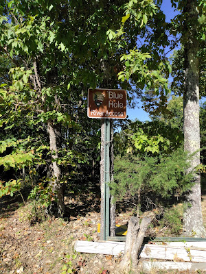
     There are quite a few ‘Blue Holes’ on the Buffalo, this Blue Hole #5 is upstream from the Carver Campground, and just downstream of river mile 62 .  When driving south on Highway123, before reaching the river there is a small sign at a dirt road which says, ‘Blue Hole’, it’s easy to miss.  The road heads west for half a mile then turns south and starts downhill for another three quarters of a mile to Blue Hole Campground.  There are five designated campsites, a vault toilet and a small parking area. easy to miss sign      The beach area on a gravel bar, wrapping around the inside of a bend in the river, is about a quarter mile long and made up mostly of small river rock.  I didn’t find any sand, though I didn’t walk around the entire beach.  No shade either on this south facing point, a family down the beach about a hundred feet has a portable shade room set up on the cobblestones.      We set our beach chairs fifteen feet from the water and walk in.  It gets deep pretty quick, ar